The Greater Saint-Emilion Area

23Results

  • The Greater Saint-Emilion Area

    The Greater Saint-Emilion Area

    To know more about
    YOU HAVE CHOSEN TO DISCOVER THE GREATER SAINT EMILION AREA? YOU WILL NOT BE DISAPPOINTED!     A world-famous region, the Greater Saint-Émilion Area has a rich heritage, marked by the omnipresence of the vine and historic buildings from different eras and architectures, forming the villages and hamlets characteristic of the area.   From the banks of the Dordogne to the cultivated terraces and limestone plateaux, the varied landscapes of the Greater Saint-Émilion Area will surprise you during your visit!   Romanesque, Gothic or monolithic churches mark out the territory like landmarks for visitors on a stroll, while "chateaux" and manor houses spring up here and there as a nice unexpected surprise!   The preservation and development of this unique terroir and heritage make the Greater Saint-Émilion Area an exceptional territory. So enjoy your discovery!     These are the 22 communes that you can visit during your trip:   SAINT EMILION SAINT CHRISTOPHE DES BARDES SAINT LAURENT DES COMBES SAINT HIPPOLYTE SAINT ETIENNE DE LISSE SAINT PEY D’ARMENS SAINT SULPICE DE FALEYRENS VIGNONET MONTAGNE LUSSAC PUISSEGUIN LES ARTIGUES DE LUSSAC PETIT PALAIS ET CORNEMPS NÉAC FRANCS TAYAC SAINTE TERRE GARDEGAN ET TOURTIRAC SAINT CIBARD BELVÉS DE CASTILLON SAINT GENÉS DE CASTILLON SAINT PHILLIPE D’AIGUILLE
  • Belvès-de-Castillon

    Belvès-de-Castillon

    To know more about
      Belvès-de-Castillon is a municipality of the Great Saint-Emilion Area and a part of the Canton of Coteaux de Dordogne. It is located at about 10 km from Saint-Emilion and 16 km from Libourne, its area is 661 hectres. Today the town has 333 inhabitants, and they are called Belvésiens and Belvésiennes.     > A BIT OF HISTORY   Origin of the name Belvès-de-Castillon takes its name from the contraction of Latin bellus visus or of Occitan Viso Bello, meaning "beautiful view". The ending "-de-Castillon" was added in 1913 and is referring to the neighboring town of Castillon-la-Bataille and distinguishing the town from the municipality of Belvès in the neighboring Dordogne area. In Gascon, the name of the city is Belvès-de-Castillon.   History The territory of Belvès was part of the lordship of the Castegens founded in the 15th century by the powerful Grailly family.  During the Revolution, the parish of Notre-Dame de Belvès formed the town we know today as Belvès. Like the neighboring town, Castillon-la-Bataille, Belvès-de-Castillon is at the heart of events that marked the end of the Hundred Years War. It now participates in the big reenactment, which commemorates the battle of Castillon.     > A NATURAL HERITAGE   The town is crossed by several rivers: the Lydoire, the Brande, the Rieuvert and the Aiguille.     > VINEYARDS   This rural and wine-growing community is incorporated to the controlled appellation "Castillon Côtes de Bordeaux."   In 2015, the town of Belvès-de-Castillon got the label "Territoire Bio Engagé” (Organic committed Territory) awarded by Arbio Aquitain.     > POINTS OF INTERESTS   The Castegens castle was built in the Middle Ages. It is a rectangular residential building covered with flat roof tiles. It is surrounded by a rectangular enclosure with angular towers, parts of which are now destroyed. During the Second Empire (mid 19th century), a winery was added to the castle. In recent years, the Castegens castle has become the fous point of the reenactment of the Battle of Castillon, the last battle of the Hundred Years War.   The Notre-Dame church was built in the 19th century, dedicated to the Virgin Mary, whose cult is widespread. The church is most certainly succeeded by an older building; the sobriety of its facade recalls Romanesque architecture. This church has a Merovingian capital listed as historical monument object.   The town hosts the biggest cultural show in Aquitaine: "The Battle of Castillon" in July and August the show evokes English Aquitaine and the ultimate battle at Castillon, between the Anglo-aquitaine forces and the French army of Charles VII at the Castegens Castle.     > OPENING DAYS OF THE CITY HALL   Monday, Tuesday, Thursday, Friday from 9:00 am to: 1:00 pm. Friday: from 9:00 am to 1:00 pm and 3:00 pm to 6:00 pm.  
  • Francs

    Francs

    To know more about
    Francs is a town of the Greater Saint-Emilion Area and is also part of the Canton of North Libourne. It is 14km from Saint Emilion, on a hill culminating at 96 meters, and is spread over 359 hectares. Today the town has 190 inhabitants, called Francs.     > A BIT OF HISTORY   The town of Francs was named after a historical event when Clovis, the first king of the Francs, allied with Gondebaud; they are victorious against the Visigoths at the Battle of Vouillé in 507 and seize Aquitaine. He leaves a detachment of the Frankish army that attaches itself to the town to protect it; which took the Latin name "Ad Francos", that is to say, “To the Franks” which later became "Francs". Between 1793 and 1930, its name changed to "Franc" and then “Francs” as it is known today.   By the 9th century, a Lord of the Segur family decided to build a castle, which was then attached to the lordship of Puynormand and their barony. In the 16th century, the Segur family converted to Protestantism, which led them to completely disappear from Francs, at this point another line of lords; the Gaufreteau that succeeded them. Today the castle, partially restored, and the Romanesque church remain as precious relics of the past.     > A NATURAL HERITAGE   About 2.7 km of rivers, including the Ruisseau De Coudot (length 2.6 km) and Le Palais (length 0.1 km) flow through Francs. A large majority land in Francs is devoted to farming.   > VINEYARDS   "Humble pearl of the Bordeaux Area, the Bordeaux-Côtes-de-Francs nonetheless represent one of its most precious stones. For now it shines only for itself and some amateurs, but its delicate and discreet glow may well in the future eclipse more established glories." - Jean Paul Kauffmann   The appellation of Francs Côtes de Bordeaux AOC was recognized. This is one of the smallest appellations of Bordeaux. It represents 500 hectares of vineyards with many small wine estates. Learn more about the vineyards of Saint Emilion, here.     > POINTS OF INTERESTS   At 96 meters, Francs offers a beautiful panoramic view over its surroundings: the vineyards, the forests ...   Cycling routes such as "Churches and castles in Lussacais" can be found at the Tourist Office, and pass through Francs. The routes can be downloaded here also.    Two witnesses from the past:   - The Church of Saint-Martin of Francs: is a Romanesque church, built in 1605 on a knoll, among the 22 parishes that formed the lordship of Puynormand. Overlooking a landscape of vineyards, it is the only listed historical monument in the village of Francs dating from the 17th century.   - The Castle of Francs: The castle, built in the 9th century was built entirely of stone. It is the largest castle in the Lussac area and benefits from a strategic location on a high hill; enabling the town's predecessors to  defend the territory when troops arrived from Castillon or Entre-de-Mers.   The castle, built by a lord of Segur, was plundered at the time of the Religious wars by the Protestants of the region. During the Revolution, it was also mutilated. The frame that remains today dates from the 14th century. Its porch reflects the many restorations made necessary after the invasions the building suffered.     > OPENING DAYS OF THE CITY HALL     Monday to Friday: 8:00 am.  to 11:30 am. - 1:30 p.m. to 5:30 pm Friday: 8:00 a.m.  to 11:30 am. - 1:30 pm. to 5:00 pm Saturday: 8:00 a.m.  to 11:30 am. - 1:30 pm. to 5:30 pm Sunday: 10:00 a.m. to 11:30 am. - 1:30 pm. to 5:30 m.
  • Gardegan-et-Tourtirac

    Gardegan-et-Tourtirac

    To know more about
      Gardegan-et-Tourtirac is a town of the Great Saint-Emilion Area and part of the Canton of Coteaux de Dordogne. It is located 20 km east of Libourne and 11 km from Saint-Emilion. Its area is 960 ha. Today the town has 286 inhabitants, and they are known as Gardeganais and Gardeganaises.     > A BIT OF HISTORY   Origin of the name The name of the town originates from a guard post of the castle of La Pierrière, which was linked to the powerful Segur family. The municipality was born from the merger of Gardegan-et-Tourtirac.   History Gardegan-et-Tourtirac is a wine growing municipality which seems to have been inhabited since prehistoric times.   During the Revolution, the Saint Martin Parish of Gardegan form the town of Gardegan and Saint-Pierre Parish of Tourtirac joined together to form the municipality of Tourtirac. In the year IX (1800), the town of Tourtirac was linked to Gardegan and became Gardegan-et-Tourtirac.   The powerful Segur family strengthened the position of Gardegan and built the castles of Pitray and La Pierrière. It is likely that the castle of La Pierrière was the guardhouse of Gardegan in the 13th century.     > A NATURAL HERITAGE   The municipality contains about 1 km of river, mainly including Lidoire and Lechout.     > VINEYARDS   Gardegan-et-Tourtirac produces a wine of the appellation Castillon Côtes de Bordeaux.   > POINTS OF INTERESTS   The Saint Martin Church is a Romanesque church with a Poitevin style façade, a portal with bare arches and a single nave. It is listed historic monument. Above the door there are capitals that adorn the heart. The bell and its square bell tower date from 1741.   The Saint-Pierre Church dates from the 12th century, is a fortified church. It has a paneled nave, with a dome on pendants, a vaulted apse-dome and a square bell tower. It is a Romanesque building inspired by the local spirit. The church was degraded during the Religious Wars in the 16th century.   The Château of Pitray, classified as  a historic monument, was built in 1868 on the site of old houses from the 15th century, it has a Gothic-Renaissance style as interpreted by Viollet-le-Duc. It was designed by the Bordeaux architect Alphonse Blanquière. The surrounding park is designed around the same time, with majestic trees that form a green screen. The Pitray land belonged for a long time to the Segur family. The large park was designed by the Bordeaux nurseryman Jean Escarpit.   Dolmen located on the wine estate of the Château Pitray, consists of two vertical stones supporting one or more big slabs and were called tables, now it has disappeared.   Château La Perriere built in the Middle Ages, has undergone several changes since. Its moat is on the site of an ancient monolithic cellar. It was enlarged in the 17th century by the family Lageard, by adding a large courtyard and a chapel. In 1867, a neo-Gothic tower is built at an angle. Today, banana trees decorate the courtyard and the castle which give it an exotic touch.   The Saint Emilion Golf Club designed by the architect Tom Doak, it is a 5-star golf consisting of 18 holes. More information here.     > OPENING DAYS OF THE CITY HALL   Monday: 8:15 am to 12:30 pm and from 1:30 pm to 6:30 pm Thrusday: 1:00 pm to 7:00 pm Friday: 8:15 am to 12:30 pm
  • Les Artigues-de-Lussac

    Les Artigues-de-Lussac

    To know more about
      Artigues-de-Lussac is a town belonging to the Canton of North Libourne and part of the community of villages of the Greater Saint-Emilion Area. Its area spread over 1016 hectares and is located 5 km from Saint-Emilion. Today the town has 1,101 inhabitants, called the Artiguais and Artiguaises.   > A BIT OF HISTORY   Origin of the name   The names of Artigues is a word of Celtic origin meaning "clear".   History   During the Revolution, the Saint-Pierre of Lussac parish formed the town of Lussac. On August 14th 1869 the municipality of Lussac was fragmented to form the town of Artigues-de-Lussac. Thus, it is a recent town whose history is intertwined with that of Lussac.   The area of Artigues-de-Lussac was occupied for a long time. It is known that a Celtic tribe lived in the Faize forest. But there are no remains or material traces of ancient Celtic altars because of the Roman settling in the region; as they destroyed everything that was related to the celtic religion.   Since the 12th century the village began to develop with the construction of the abbey and the church of Faize. The religious community also attracted lay people who began settling in the area and the population grew over the following centuries.   However, at the time of the Revolution, the abbey was sold as national property and the church of Faize disappeared. It was only in 1830 that the authorities allowed the neighboring inhabitants of Artigues to build a new church, whose construction was completed in 1852.     > A NATURAL HERITAGE   The town is crossed by the De Lavie and Petit Palais Creeks, there are over some 4 km of waterways along the village..   > VINEYARDS   Today, the main source of income in the town of Artigues-de-Lussac is viticulture, producing wines from the appellation Bordeaux supérieur.     > POINTS OF INTERESTS   The Tourist Office of the Greater Saint-Emilion Area offers a 1h30 hiking route through the town of Artigues-de-Lussac, "Les Artigues-de-Lussac" allowin for the discovery of the Abbey and wines from the area.   "History and heritage around Montagne" is a fairly easy bike route of 15 kilometers for a 1h30 bike ride through Les Artigues-de-Lussac.   The airfield of Libourne, on the municipality of Artigues-de-Lussac is ideal for a first flight or a flight initiation.   The Sacré Coeur parish church is built in a neoclassical style of the 19th century. Its interior frescoes and stained glass windows have to be visited and have been completely renovated thanks to the parish association of Artigues-de-Lussac.   The abbey was founded in 1137 by Viscount Pierre de Castillon who then depended on the Cistercian order. Enlarged and rebuilt in the 17th century before being sold as national property during the Revolution. The roof and stones were partly sold to build the surrounding buildings and the remains of the early church dedicated to the Virgin. What remains of the convent is now fully restored by its ultimate recipient, Maurice Druon, former minister of Culture and author of the saga The Accursed Kings. Today, Maurice Druon rests in peace  in the former choir of the abbey.   > OPENING DAYS OF THE CITY HALL    Monday: 1:30 pm to 6:00 pm Tuesday: 9:00 am to 12:00 pm and 1:30 pm  to 6:00 pm Wednesday: 8:00 am to 12:00 pm Thursday: 9:00 am to 12:00 pm and 1:30 pm  to 5:30 pm Friday: 9:00 am to 12:00 pm and 1:30 pm  to 5:00 pm
  • Lussac

    Lussac

    To know more about
    Lussac is a town of the Greater Saint-Emilion area and the head town of the Canton of North Libourne. It is 9 km from Saint Emilion and its area is 2,343 hectares. Today, the town has 1,269 residents, and they are called the Lussacais and Lussacaises.   > A BIT OF HISTORY   Origin of the name   Lussac owes its origins to a Gallo-Roman character, Luccius, who moved into the region and built his city Luccianus in the vineyards, whose territory determines the first boundaries of the village.   Some may see another origin of the name of Lussac in the sacrificial stone on the mound of Picampeau, since the Gallic term "Lukus" meant "sacred wood", that is to say, a place of religious rites.   History   Lussac is dominated by the Gaulish megalith of the mound of Picampeau, where sacrifices were helded before the Christian era. Centuries later, Lussac is destroyed by the barbarian invasions. It is not until the 12th century that Cistercian monks highlight the region, especially for the church's reconstruction. Many wineries settled next to the Luccius villa and English Aquitaine made the local wines famous in England. Lussac gradually became a coveted town from the 17th century, in particular by the Bordeaux parliament who built several châteaux.   Lussac commerce also contributes to its dynamism. It has held up to twelve fairs per year since 1834.   > A NATURAL HERITAGE     In 2015, the National Council of the Towns and Villages in Bloom of France awarded two flowers to the town at the Contest of towns and villages in bloom.   The town has more than 11 km of rivers, mainly including: the stream of Gendarme, the stream De Lavie, the Palais and Petit Palais.   > VINEYARDS     Lussac is a town near Saint-Emilion which is distinguished by its early viticulture and quality of its wines which are renowned.   The Lussac-Saint-Emilion is a dry red wine, within the still wine category. The appellation Lussac-Saint-Emilion is part of satellites wines of Saint-Emilion (more info here).     > POINTS OF INTERESTS     The Château of Lussac is located in the center of the village. The "primitive" castle belonged to the Montauroy family and was completely destroyed in 1898. The current building was built in five years, and is inspired by classical buildings that were in France in the 19th century.   The Church of Saint-Pierre, originally built in wood, was replaced in the 12th century, after a fire, by a Romanesque building, rebuilt in the 14th century. After being rebuilt, the church was ruined again in 1587, following the Religious Wars and finally fully restored in the 19th century. The bell tower and its spire were added and the nave modified. The restoration of Saint-Pierre's Lussac church was completed in 1874 with the installation of a bell.   The villa Luccius, of which some remains can still be seen, is a Gallo-Roman domain, originally named Lussac. The Luccius’s territory, a Gallo-Roman character, is a vineyard that determined the first village limits. There remains today a few foundations at the heart of a vineyard.   The Gaulish megalith of the mound of Picampeau, a stone where pagan sacrifices took place, also called Stone of the Martyrs, demonstrates the many Celtic rituals practiced at the time.   The House of wine and tourism of Lussac whose mission is to discover and promote the wines of the satellite town of Saint Emilion. Built in the late 18th century for Paul Montouroy it has also served as a town hall, police station, court house, private school, theater and eventually  the property of the communal wine union.   A bike path offered by the Tourist Office through Lussac: "Churches and castles around Lussac" takes about 3 hours to complete (30 km). You can download the route here. The town hosts a market every Thursday morning.     > OPENING DAYS OF THE CITY HALL   Monday and Wednesday: from 8:30 to 12:30 and from 2:00 pm to 6:00 pm Tuesday and Thursday from 8:30 am to 12:30 am Friday: 8:30 am to 12:30 am and from 2:00 pm to 5:00 pm
  • Montagne

    Montagne

    To know more about
      Presentation of the municipality Montagne is a town of the Great Saint-Emilion Area and part of the Canton of North Libourne. The village is 97 meters above sea level and is located 6km from Saint-Emilion. Its area is 2,670 ha. Today, the town has 1,542 inhabitants called the Montagnais and the Montagnaises.   A bit of history… Origin of the name The name derives from the Latin "montis" (hill), but also "Montane" low Latin, and finally "Montagne" in Gascon. History It seems that Montagne has been inhabited since Neolithic times, the village has preserved testimonials of this activity on the site of Malengin. Objects from the Copper Age and the Bronze Age have been found there. There are also a few villas of the Gallo-Roman era: the remains of the villa of Ausone, the villa Lucaniacus but also sarcophagi and mosaics. At the fall of the Roman Empire, the region was placed under the supervision of Christian bishops. In the 11th and 12th centuries, religious life in Montagne was very active, with the construction of three churches. In the Middle Ages activities such as the exploitation of limestone quarries began. Montagne was part of the Puynormand castellany and remained so until 1602 when Henry IV sold the lands he owned. Purchasers were committed to the prosperity of their lands by notably developing the viticulture. They enjoy the protection of the king for the promotion of their products and therefore their wines quickly became a huge success that has carried on into the modern day. In 1973 the mayor and his council voted for the replenishment of the town by bringing together the three neighboring parishes: Montagne, Parsac and Saint-Georges, whose main source of income is wine making.    Natural heritage (...) The town is crossed by a small stream, the Barbanne. the name means boundar, with the pays d'oc on the Saint-Emilion side and oil on the Montagne side.   Vineyards… Attached to Saint-Emilion, the town of Montagne is marked by vineyards and produces high quality wines. Montagne today produces famous wines of the Montagne-Saint-Emilion appellation ; and is part of the Saint-Emilion satellites appellations.   Points of interest:   Saint Martin church, built in the 12th century, it has undergone many restorations over the centuries. It has a bell tower consisting of square towers at the intersection of the transepts and the nave. On the west side, there is a door with seven arches and capitals evoking fantastic heads. Overall, the tower, transepts and apses, have a harmonious balance. Inside, there is a beautiful cupola of the 12th century, unique to the Libourne area; which is a truly a sign of the beginning of Gothic vaults on intersecting ribs.   Saint Georges Church located in Saint Georges (a hamlet 850 meters from Montagne), it boasts an exceptional three-storey tower. It stands above the village and vineyards. The church dates from the 11th century and was built on the site of ancient Roman ruins. It is certainly the oldest of the castleny of Puynormand. Its bell tower is original, narrower at the base than at the top and stands at a height of 23 meters.   Notre Dame de Parsac is the smallest church of the town of Montagne. It was built by the British after 1450, following a dilapidated church. Many restorations were then succeeded over the centuries, including one in 1992 to prevent the collapse of the building.   Chateau of Towers was built in the 14th century and has two polygonal keeps with two circular towers. Outside the castle there is a chapel   Château Saint-Georges built well before the 17th century, it was sold in 1602 by Henri IV during the dismantling of the castleny of Puynormand. Built in a U-shape, the ancient castle and its four towers were designed by the architect Victor Louis.   Underground shelters of the 6th century in the locality of Malengin in Parsac discovered by Mr. Millangue who also discovered a limestone quarry for grinders whose exploitation dates back to the 11th century.   Remains of windmills of Calon (17th century) on the mound of Calon, two of them were rehabilitated. The mills were in operation until 1930.   The hiking loop of the Bois de Bonde of 4 km, is an interpretive trail through the vineyard landscape.   Five bike routes, from Montagne, are proposed by the Tourist Office of the Greater Saint Emilion Area. You can find the routes here.       Opening days of the City hall Monday, Tuesday and Thursday: 8:30 a.m. to 12:15 p.m.  and 1:45 p.m. to 5:30 p.m. Wednesday: 1:45 p.m. to 5:30 p.m. (every month, closed last Wednesday all day) Friday: 8:30 a.m. to 12:15 p.m. to 1:45 p.m. / 5:00 p.m.  
  • Néac

    Néac

    To know more about
      Presentation of the municipality Néac is a town of the Greater Saint-Emilion Area and part of the Canton of North Libourne. Located 10 km from Libourne, it is also located 10 km from Saint-Emilion, on a hill that stands at 54 meters high, its area is 688 ha. Today the town has 377 inhabitants, and they are called Néacais and Néacaises.
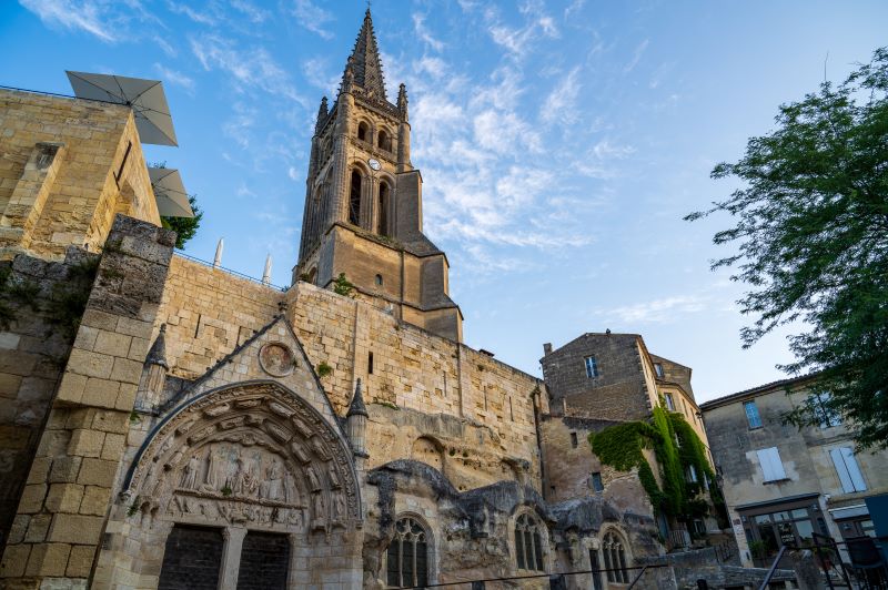
   A little history… Origin of the name The name of the town Néac is the contracted form of Naujac which probably derives from Noviacus or Novius, words of Gallo-Roman origin. History Néac is a town in Gironde whose proximity with Pomerol has encouraged the wine vocation. The origin of the names of some localities of the town of Néac such as Sauriac or Sivrac, derivatives Sivriacus and demonstrates the existence of a Gallo-Roman civilization although few traces remain of that time because of lootings from Germanic invasions. In the Middle Ages, the parish of Néac is attached to the lordship of Puynormand, which included 22 parishes. Néac is also marked by its wine and energy that has been shown by winemakers to obtain AOC whose history was eventful: the wines have carried the names of Pomerol or Néac-Pomerol and Néac ever since.   A natural heritage The town is crossed by the Barbanne of approximately 2.5 km.   Vineyards… In the municipality of Néac, red wines can get the name Néac, however as the village is not well-known, many wine producers perefer to label their products under the name of Lalande de Pomerol.   Points of interest: The Tourist Office offers routes through the town of Néac: - A walking hike "Néac - Lalande de Pomerol" a 4 km hike of about 1 hour - A bike ride "Néac - Lalande de Pomerol" a 13 km bike ride taking about 1h15 You can find all the routes here.   Monuments to discover: The Château Siaurac is an example of the important wineries in the town of Néac. This classic architecture château shows the outline of the previous castle, and has a symmetrical façade on two levels. The south side overlooks a park, while the opposite side opens onto a courtyard surrounded by two wings in which one can finds offices, cellars and various facilities necessary for such a wine estate.   The town of Néac retains a Mission Cross of the late 19th century. It demonstrates the commitment of the Church to revive the faith at the end of the century while churchgoers became few. The Church then organized missions, consisting of sermons and religious ceremonies, usually in several places. With such activity, most often, resulting the setting up of a memorial cross, as an important and sober message.   The Church of Saint-Brice of Néac is a large 19th century building that overlooks the Barbanne creek. It stands on the site of a former building of the 11th century. This former more primitive church gradually appeared too small, and was thus subject to alterations and enlargements. The church was then known for its statues of St. Cosmas and St. Damian; to whom local people dedicated a special devotion. The old church was razed to the ground and a building was rebuilt in 1866 because it was deteriorating over time and threatened to collapse. The church today has a traditional architecture of the 19th century. The church is dedicated to Saint-Brice, deacon of St. Martin whom became bishop thereafter.       Opening days of the City hall Monday, Tuesday and Thursday from 9am to 12pm and from 2:00pm to 5:30pm Friday: 9am to 12pm and from 2:00pm to 4:00pm
  • Petit-Palais-et-Cornemps

    Petit-Palais-et-Cornemps

    To know more about
      Presentation of the municipality Petit-Palais-et-Cornemps is a town of the Great Saint-Emilion Area and belongs to the Canton of North Libourne. Located in the district of Libourne, it is 16 km from Saint-Émilion and has an area of 1,432 ha. Today the town has 724 inhabitants, and these are called the Petits-Palaisiens and Petits-Palaisiennes.   A bit of history… Origin of the name Petit-Palais comes from Gallic blades when to Cornemps name of Gallo-Roman origin meaning sacred place. Formed by the merger of two municipalities on March 21st, 1816. History The current town of Petit-Palais-et-Cornemps was formerly divided into two less distinct villages. It included Petit-Palais et Cornemps, owned by Puynormand, better known under the name of castellany Puynormand in the Middle Ages. Strongly marked by religion, the town has two churches that were the scene of violent clashes between Protestants and Catholics in the late 16th century during the Wars of Religion. The Notre-Dame and Saint-Pierre church, built respectively in the 11th and 13th centuries, remain fine buildings. During the Revolution, the Saint-Pierre de Palais parish (or Petit-Palais) form the town of Petit-Palais and the parish Notre-Dame of Cornemps (of Saint-Pierre of Camps) forms the town of Cornemps. On March 21st, 1816, the municipality of Cornemps is linked to that of Petit-Palais and they became Petit-Palais-et-Cornemps.   A natural heritage The Le Palais and Gendarme creeks roam the town over some 7 km.   Vineyards… Petit-Palais-et-Cornemps is a town of 320 hectares of vineyards in Bordeaux and Bordeaux Supérieur. The village benefits from 11 wineries, producing various wines of the Bordeaux appellation for over 2 centuries.   Points of interest It is said that the village is on of the many stops along the pilgrimage of Santiago de Compostela . The tradition recalls the miracles that gave rise to the pilgrimages, the Saint Blaise’s day in Cornemps. The Tourist Office of the Greater Saint-Emilion Area offers hiking trails on Petit-Palais, downloadable here.   The town has two listed historical sites studied for their remarkable features: The Saint Pierre church of Petit Palais and Notre Dame of Cornemps church. The Saint-Pierre is a listed building of the 13th century. The particular front is a marvel: one of the finest Romanesque façades in the region, with beautiful proportions and a lot of carvings. Give a special attention to the various surprises that can be discovered: the thorn shooter above and right of the door; two lions with oriental style that overcome false doors;almond tori covered of wolf teeth; archivolts and varied capitals. This is the richest Romanesque façades of the Gironde. The Notre Dame of Cornemps Church of the 11th century is listed as a historical monument. The entire western part of the church is in ruins. Its exterior, generously topped with thick ivy, reveals canted columns, roughly carved cornice brackets with figures of men or mouths of animals.   The town of Petit-Palais-et-Cornemps is also rich in heritage : fountain and wash house, crossroads crosses, dovecote, bread oven, etc ...     Opening days of the City hall Monday and Friday from 9am to 12pm and from 2pm to 6:30pm Tuesday and Thursday from 2pm to 6:30pm Mercredi: from 9 am to 12 am
  • Puisseguin

    Puisseguin

    To know more about
      Presentation of the municipality Puisseguin is a town of the Great Saint-Emilion Area part of the canton of North Libourne. It is located at 7.4 km from Saint-Émilion and its area is 1,725 hectares. Today the town has 873 inhabitants, and they are called the Puisseguinais and the Puisseguinaises.   A bit of history… Origin of the name The town takes its name from puy, which means "mountain" and Seguin, who was one lieutenant of Charlemagne. History In the 14th century, Puisseguin is a small castle-dependent of Puynormand, and extending to Parsac. The Seguin family, really powerful family in the area during the Middle Ages settled on the site in the early 8th century and began to build a castle. In May 1341 the lordship of Puynormand, which depends of Puysseguin, is attributed to the Albret family, who kept it until the 17th century. During the Revolution, Saint-Pierre parish of Puisseguin formed the town of Puisseguin and Saint Martin Parish of Monbadon formed the town of Monbadon. On January 1st 1989 the municipality of Monbadon was related to that of Puisseguin. The vineyards, cultivated since the Middle Ages, took off in the 18th century with the introduction of new varieties and under the influence of Pierre Combret de La Nauze who urged the potential of this terroir facing south. Since this moment it has received the AOC Puisseguin-Saint-Émilion.   A natural heritage The town of Puisseguin are crossed by various creeks : the Barbanne, the Palace, the Vanelle, the Rouille and the Bernon.   Vineyards… The appellation "Puisseguin-Saint-Emilion" covers 750 ha and is declined by the many chateaus and wine cooperatives installed on the town Another label is present on 238 ha in the Monbadon sector; these are the "Castillon - Côtes de Bordeaux", formerly called "Côtes de Castillon".   Points of interest: To discover the territory, several biking and hiking routes are offered by the town to discover the heritage and themed routes. The Tourist Office of the Great Saint-Emilion Area also offers the bike route "Churches and castles in Lussacais" starting from Montagne and last for 1h30. The feudal castle Monbadon was built in the 14th century in the municipality of Monbadon-Puisseguin, originally watchtower. A real stronghold is then built to provide a line of defense with the castles of Malengin and Puisseguin between Castillon-la-Bataille and Puynormand. Since 1602, under the reign of Henri IV, King of France and Navarre, the same family still owns the entire field. Many lords, barons of Monbadon, succeed. Monbadon Castle now has a vineyard of 25 hectares and is one of the last testimonies of medieval military architecture remaining in Gironde.   Puisseguin Castle is a castle of the 14th century built in 1314. It still has defensive elements of time. The main façade presents some fortification elements: it is punctuated by two round towers crowned with battlements and surmounted by small towers with roofs shaped snuffer. Two doors of different sizes are used originally, one for cars and one for pedestrians.   The Saint-Martin Church was built in the early 11th century, preserved moldings testify to that time. His name is the name of a very popular saint in France, with almost 500 towns with this name and that about 4,000 churches dedicated to him. Its portal is Romanesque and the church has a sundial from 1630.   The Church of Saint-Pierre in essentially Romanesque architecture dates from the very end of the 12th century and has been modified and enlarged in the 15th century. All that remains of the first period that the lower part of the façade and the first two bays of the nave. In 1786, the church knows many transformations, the upper part of the façade was redone in modern times.     Opening days of the City hall Monday to Thursday: 8:30 am  to 12:30 pm and 1:30 pm to 5:30 pm Friday: 8:30 am to 12:30 pm and from 1:30 pm to 4:30 pm
  • Saint-Christophe-des-Bardes

    Saint-Christophe-des-Bardes

    To know more about
      Presentation of the municipality Saint-Christophe-des-Bardes is a town in the Canton of North Libourne and part of 8 towns of the Jurisdiction of Saint-Emilion. It also belongs to the Community of the municipalities of the Greater Saint-Emilion Area. Its area is 780 ha and is located near Saint-Emilion (2 km). The town now has 443 inhabitants, called the Saint-Christophais.   A bit of history… Origin of the name The name "Bard" dates back to a distant time. These are religious Christians, formerly called "Druids" who had settled in the land where they organized and animated social life. History The origin of Saint-Christophe-des-Bardes is originally from the establishment of the Celts and therefore is very old. In the Middle Ages, a castle was built in the town, Château Laroque. Its lords settled in this territory for a long time. The history of the town, is also marked by the extraction of the stone. Just like in Saint-Emilion, its underground is dotted with limestone quarries where were extracted blocks of stone used to build houses and castles. Saint Christophe des Bardes consists mainly of scattered hamlets and old houses which are highlighting its sublime vineyard. The village is twinned since 1996 with the village of Hermance in Switzerland lying at the edge of Lake Geneva near Geneva.   Natural heritage (...) The town is crossed by the Barbanne over a length of 2.3 km.   Vineyards… Nowaday, the main activity of the town is wine exploitation: 70 wine estates share the 547 hectares of vineyards, producing wines that are exclusively within the controlled appellation of Saint-Emilion wines.   Points of interest: The Tourist Office offers various hiking through the town of Saint-Christophe-des-Bardes. A hike “Terroirs" for a 3-hour-walk approximately and two bikes hikes "Route of the remarkable architectures" of 19 kilometers and  "Family Properties" of 11,5 km. You can download the maps here.   Every year during the last weekend of July, the village fair is organized. Young and old gather around a convivial meal followed by various outdoor games, the presence of bandas, bull de fuego and joyful a disco dance.   The château Cantin is an old noble house named after the stream, the Cantin, which originates at the bottom of the hill. It was founded in the Middle Ages but the well in the heart of the vineyard, is the only remain of the Middle Ages. Most buildings in the courtyard date from the 17th century. They were built by Benedictine monks and had a function of farm and monastery. The main body of the castle was the summer residence of the canons of Saint-Emilion. The monks remained in Cantin until the French Revolution and the estate was sold as national property to the Baron of Mauvezin, it was kept in the family for 100 years. Alphonse Bisch, a wine merchant, remodeled the castle in the 19th century: since, it has beautiful buildings on two levels including a square tower. The building is complemented with a large courtyard.   The château Fombrauge is a beautiful aristocratic mansion built on a vast vineyard. It consists of a main building in one level and two perpendicular wings. The facade overlooks a courtyard framed by remarkable buildings. The north side has a carved stone terrace overlooking the park.   The château Haut-Sarpe is at the limit of the town of Saint-Christophe-des-Bardes and Saint-Emilion. Located at the top of a hillock overlooking the vineyard, it has a beautiful view of the Barbanne valley, steeples of  Montagne, St. George, Parsac and also Lussac. The castle was built by the famous Leo Drouyn in the 19th century. He was the official drawftsman of the Committee on Historical Monuments of the Gironde, he was the first to highlight the rich romanesque heritage of Gironde and became one of the leading specialists of medieval architecture. Leo Drouyn was inspired by the Petit and Grand Trianon at Versailles with a French classic aesthetic mixed with Italian influence.   The Chateau Laroque is a former feudal dwelling, rebuilt under Louis XIV. Its location allows it to dominate the Dordogne valley. Surrounded by walls, the castle was plundered during the 17th century by the troops of the Duke of Epernon. It remains an important round tower with a stone dome. The main building, dating from the late 17th century, seems to have been redesign subsequently. It has a large rectangular main building on two levels topped by a balustrade hiding the roof. The main facade, very simple, has a central front building with three bays and crowned with a triangular pediment.   The windmill of Château Haut-Sarpe, is part of a true small hamlet and has a beautiful round tower in stone topped with a conical slate roof. It is now, after restoration, in very good condition. The small heritage of the town is to visit: the wash house, the grindstone, the bread oven, the memorial and the sundial.    Opening days of the City hall Monday, Tuesday, Thursday and Friday: from 8:45 am  to 12:30 pm and from 1:30 pm to 5:45 pm Saturday: from 9 am to 12 pm
  • Saint-Cibard

    Saint-Cibard

    To know more about
      Presentation of the municipality Saint-Cibard is a town of the Great Saint-Emilion Area part of the Canton of North Libourne. It is located on the crest line between the valleys of the Dordogne and the Isle at 108 meters above sea level and 15 km east of Saint-Emilion. Its area is 354 ha. Today the town has 179 inhabitants. The municipality gets its economy mainly on its agricultural and crafts.   A bit of history… Origin of the name The name of Saint-Cibard can be derived from the name of a Roman practitioner, Eparcus, from the Latin "Eparchus" a hermit monk of the 5th century who settled nearby. History Territory occupied since prehistoric times, Saint-Cibard, is an important area, contrary to what one might think today. After Eparcus, many will imitate him by building on the hillside comfortable homes to escape from the battles and lootings. Many invasions wars ravaged this region for centuries: barbarian invasions in the Gallo-Roman time, Saracen invasions under the Merovingians, the Hundred Years War in the Middle Ages and Wars of Religion. During the French Revolution, the parish of Saint-Cibard des Combes form the municipality of Saint-Cibard.   A natural heritage None less than 1.6 km of waterways are passed through Saint-Cibard, which are the stream of Nauves, Lidoire and Puygueraux.   Vineyards… Saint-Cibard is one of three towns, with Francs and Tayac, that constituting the appellation of Francs  Côtes de Bordeaux in the Great Saint-Emilion Area.   Points of interest: The Castle of Puyfromage is from the Renaissance time. The date of 1574 was found on the main beam of the structure when it was restorated following a fire.   The royal dovecote of Puyfromage, with its cylindrical shape is a local landmark and one of the largest dovecotes in France, dating from the 12th century and containing 981 boxes called "bearers" (cavities that can receive pigeons) in perfect condition and operating.   The Romanesque church of the 12th century was dedicated to Saint-Cibard. It is characterized by its pure Romanesque style, but an elevation in Gothic style gives it a rare originality in the region.   The Castle Puygueraud is a strong house built in the 15th century on the promontory of the same name, at the source of the stream of Guérande, a small tributary of the Lidoire.   La Claverie is a fortress from the early Middle Ages, built by the English in the 14th century. Its name "claverie" is derived from the Latin word "clavis" meaning key. This house was strategically placed during the Hundred Years War, as Francs belonged to a rival lord.   The Roman ruins of the village of Saint-Cibard and the path of the Moors are also other points of interest hidden in the village.     Opening days of the City hall Tuesday, Wednesday, Thursday from 2 p.m. to 6 p.m. Friday: 8 a.m. to 12 p.m.
  • Saint-Émilion

    Saint-Émilion

    To know more about
      Presentation of the municipality Saint-Emilion is a town belonging to the Canton of the Coteaux of Dordogne and part of 8 towns of the Jurisdiction of Saint-Emilion. It also belongs to the community of villages of the Greater Saint-Emilion Area. Located 40 km north-east of Bordeaux and 8 km from Libourne, it stands on the hillside north of the Dordogne valley. The town now has 1,876 inhabitants, including 200 intramural, called Saint-Emilionnais and Saint-Émilionnaises. 
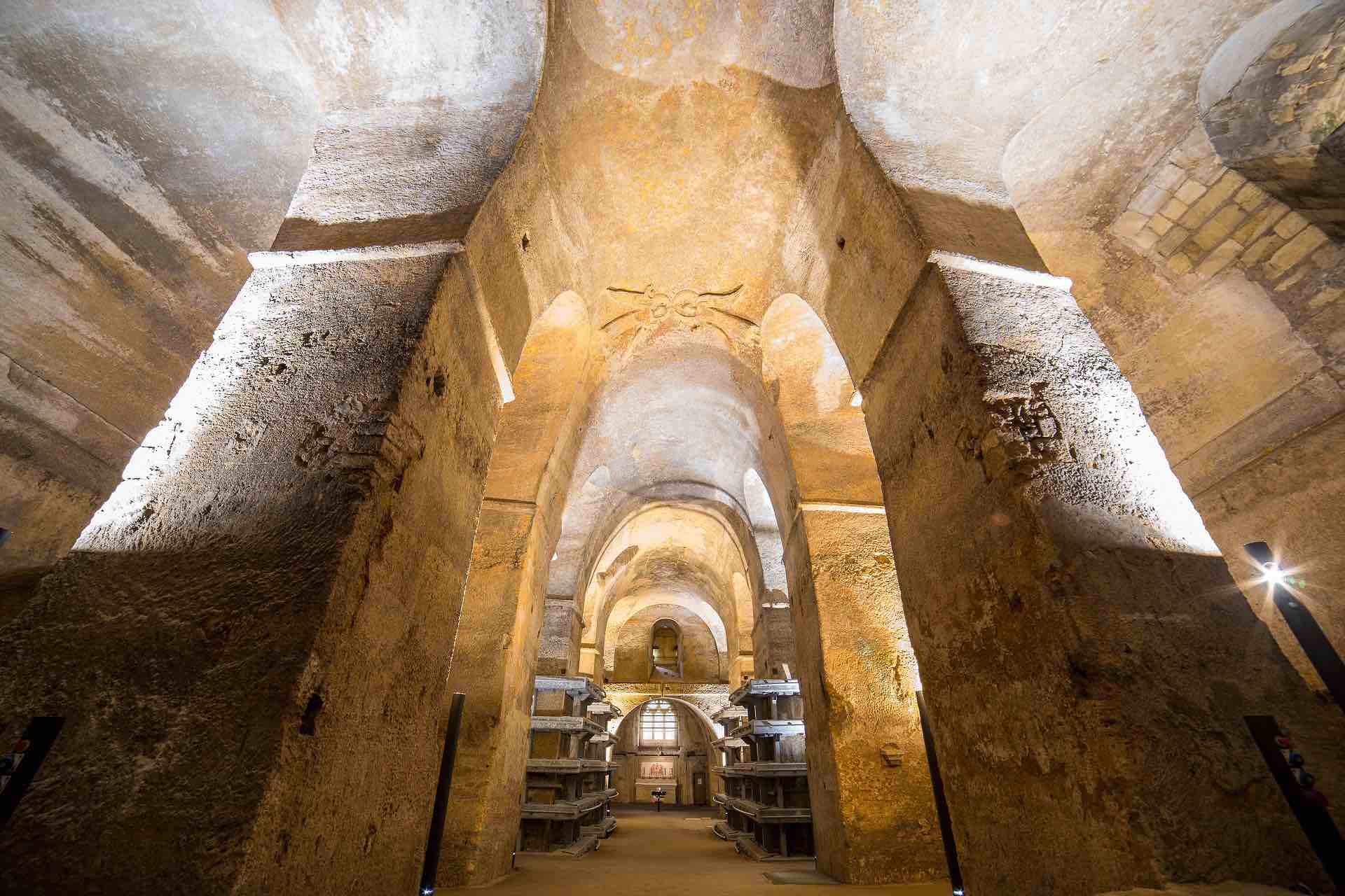
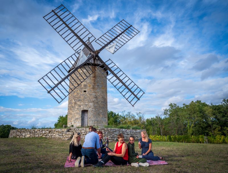
This is a historic village surrounded by vineyards, internationally renowned, visited by over a million tourists each year. It is part of the former Jurisdiction of Saint-Émilion, territory on the list of World Heritage Sites since 1999 for its cultural landscapes.   A bit of history… Origin of the name The name of the town of Saint-Emilion derives from that of the Breton hermit Émilion that settled himself on the site in the 8th century. The coat of arms shows the arms of the city. History In the 8th century, a Benedictin monk from Brittany named Aemilianus set up his hermitage in a cave in the Ascumbas forest. From the 9th to the 12th century, the catacombs and monolithic church were dug and a religious community settled under the rule of Saint-Benedict. In 1152 Aquitaine came under the English domination, favoring the growing of the vineyards and the trade of Claret wine. In 1199, the bourgeois sign a charter with John Lackland, King of England: the city gets from the king its autonomy under a dual administrative and civil guardianship: the Jurade. These new privileges were then confirmed in 1289 by Edward the 1st, King of England, which extended the powers of the Jurade to the neighboring parishes which then formed the Jurisdiction of Saint-Emilion. From the 13th to the 16th century, while the troubles begin announcing the Hundred Years War, the construction of the fortifications continued. In 1237, construction of the tower of the King, which would serve as the city hall for the Jurade, certified the Anglo-Norman style of the strong English influence in Guyenne. Later, two religious communities previously established outside the city walls, settled inside the village: the Franciscans or Cordeliers and the Dominicans or Jacobins. The city passed successively from the English to the French crown until the peace treaty was signed in 1453 after the Battle of Castillon. But peace would be short lived as the Religious Wars erupted from 1562 and these episodes had catastrophic consequences for the village and for its vineyards. the Protestants perpetrated two lootings in 1580 and in 1589 which resulted in the disappearance of the relics of Emilion. The French Revolution destroyed the religious life and depopulated the then city; degradation of monuments would worsen, and  in 1789 the Jurade was dissolved. In 1793, Elie Guadet, a "Girondins" deputy at the Convention, fled the Terror (La Terreur) and returned to his hometown seeking asylum for himself and six of his fellow outlaws. They remained nine months in hiding before being discovered and executed. The wine revolution began in the second half of the 18th century by owners of wineries open to new ideas and new techniques. In 1884, winegrowers of Saint-Emilion created the first Winegrowers Union of France becoming the principal engine of exceptional quality policy on the vineyard ever since. This would lead to the establishment of the Saint-Emilion controlled appellations production area in 1936, and the revival of the Jurade in 1948 as a brotherhood passionate about wine and whose role is to promote the wines of St. Emilion around the globe. The registration of the Saint Emilion Jurisdiction as a UNESCO World Heritage site in 1999 as a cultural landscape brought the 8 towns that composed it to sign in 2001 a heritage charter which aims to implement a management plan of this landscape.   Natural heritage (...) Saint-Émilion is crossed by several creeks : Taillas, Fongaband, Barbanne and the Dordogne river on about 11 kilometers.   Vineyards… The Saint-Emilion appellation represents 5,400 hectares of vineyards and is divided into two controlled appellations: Saint-Emilion AOC and Saint-Emilion Grand Cru. For more information on the vineyard of Saint-Emilion click here.   Points of interest: The bell tower of the monolithic church, the King’s keep or the Brunet gate will offer magnificent views of the medieval city and the vineyard! Several cycling and hiking routes, pass through Saint-Émilion and its surroundings and are offered free of charge by the Tourist Office. Find these routes here. The medieval village also offers 12 famous monuments to discover. Find them here. The village hosts many events, including: The Jurade, the Philosophia festival, the Jazz Festival, producers’ markets, Vino Voce festival, European Heritage Days, Art Crafts Fair, Market of taste, Montgolfiades ... Discover the complete diary of events here. The Tourist Office also offers a wide tourist offer: various tours of the city and vineyards, but also chateaux to discover and their wines to taste ... Discover the entire tourism offer at the Tourist Office right here.     Opening days of the City hall Monday to Friday: 8:30 am to 12:00 am and 1:30 pm to 5:00 pm Closed to the public on Thursdays afternoon but the call center is open.
  • Saint-Étienne-de-Lisse

    Saint-Étienne-de-Lisse

    To know more about
      Presentation of the municipality Saint-Étienne-de-Lisse is a municipality in the Coteaux de Dordogne Canton and part of 8 towns of the Jurisdiction of Saint-Emilion. Its area is 710 ha, and is located at 5 km from Saint-Émilion. The town now has 249 inhabitants, called Stéphanois. Saint-Étienne-de-Lisse is twinned with the city of Framsden in UK.   A bit of history… Origin of the name : The municipality Saint-Étienne-de-Lisse is named after the eponymous saint. History: Traces of a fortified settlement dating from the early history (circa 700 to 600 BC), the first Iron Age, were found on the Niord plateau, it is the site of the present Chateau Fombrauge.   The town of Saint-Étienne-de-Lisse is anchored in history, especially with the Chateau de Pressac, where the treaty of the end of the Hundred Years War was signed at the end of the Battle of Castillon in 1453. This thus marked the end of 300 years of British presence in Aquitaine. This small village has a rich heritage with a 12th century church. Above the village, located on the hillside, stands the Chateau de Pressac which dates back to the 14th century.   Natural heritage The town contains about 1.9 km of rivers, mainly including the Langrane Creek and the Barbanne Creek.   Vineyards… The winegrowers of the town produce wines of the controlled appellation AOC Saint-Emilion and Saint-Emilion Grand Cru. More information about the wines of Saint-Emilion here.   Points of interest: The municipality has probably the most secretive point of view over the Jurisdiction: the location is called Tourans Cross, located in a small wood is accessible only on foot and you can admire the entire vineyard landscape. Thus there is a magnificent view across the valley of the Dordogne. Several hiking trails pass through Saint-Étienne-de-Lisse, the Tourist Office of the Greater Saint-Emilion Area offers "Crossroads of the appellation" for a 2h30 hiking and a cycling tour "Route of the  remarkable Architectures " for 19 km. Downloadable here. The Saint-Etienne's Church was partily built on Gallo-Roman foundations in a shape of a Latin cross. During the 19th century it has undergone transformations. Before 1840, the church had a bell tower which stood on the crossroads of its transepts, but it was razed due to subsidence. In 1845, the bell is consolidated and put in the elevated stairwell. In this church we can find six stalls senior clerics of the Jurisdiction, arranged in the choir, and from the Collegiate Church of Saint-Emilion.   The Chateau de Pressac stands above the town and the church and dominates the Dordogne valley. After the battle of Castillon, sealing the end of the Hundred Years War (1453), the surrender of England may have taken place at Chateau Pressac. The main building dates from the 17th century, but was rebuilt in neo-Gothic style in the 19th century. According to local traditions, the castle would have had the distinction of having 27 towers; ruins of many of them still can be seen. This castle with its fortified architecture, has been amended several times: the front door - the oldest part, opens on a wall with two towers and is topped with battlements before which were formerly dug moats. The current owners have now permit the restoration of the cellar.     Opening days of the City hall Monday-Tuesday-Thursday-Friday: 9 am to 12pm / 1:30 pm to 5:30 pm
  • Saint-Genès-de-Castillon

    Saint-Genès-de-Castillon

    To know more about
      Presentation of the municipality Saint-Genès-de-Castillon is located 50 km north east of Bordeaux, 7 km east of Saint-Emilion and 7 km north of Castillon-la-Bataille. The town is part of the Canton of Coteaux de Dordogne. The area of ​​the town is 680 ha; its territory lies at an altitude between 32 and 98 meters, but the majority remains above 90 meters. It is its hilly nature of its relief that allows Saint-Genès-de-Castillon to offer beautiful panoramic views. They are 394 inhabitants and they are called Saint-Genésiens and Saint-Genésiennes.   A bit of history….   Origin of the name : The town owes its name to Genoa or Genesius, which was the name of several saints, including a comedian, martyr of Rome in the 4th century and also a bishop of Lyon in the 7th century. Throughout its history, the town has undergone three name changes: 1793: Saint Genest 1801: Saint Genef 1956: Saint-Genès-de-Castillon History: The discovery of a Gallo-Roman station in 1906 indicates the presence of human occupation at that time.   Points of interest: All over the area of the municipality of Saint-Genès-de-Castillon the rural builds are rich with around fifty heritage sites: fountains, wash houses, wells, bread ovens, dovecotse, cross vaults, wind mills, vineyard cabins ...   The Church of Saint-Genès-de-Castillon: This neo-Gothic church of the 19th century (1883) built on the site of an old Romanesque church of the 11th century that served then also the parishes of Sainte-Colombe, Saint-Etienne-de-Lisse, Parsac and probably Gardegan. This Romanesque church was restored in the 19th century (1851), however the walls of the nave threatened to collapse, so it was destroyed. The carillon consists of 4 bells made in 1887 by the Vauthier Foundry of Saint-Emilion.   Gravoux Manor (historical monument since 1964): This mansion of the late 14th - early 15th century contains typical defensive  elements of castles. This noble house belonged to François de Gramont, Lord of Bidache and Marshal of Navarre, Count de Blaye and lord of Mussidan in the first half of the 15th century. Today it is a winery under the appellation Castillon Côtes de Bordeaux and Bordeaux Clairet.   Chateau Flaujagues was originally a rectangular medieval manor dating from the late Middle Ages. In the late 15th and early 16th centuries, it was enlarged and became the seat of one of the manors owned by the Segur family. Now restored, the castle is a winery in the appellation Castillon Côtes de Bordeaux.   Chateau Estang dating from the 14th century, it was however extensively restored over the centuries since 1868;  only two sections of wall dating from the 14th remain.   A natural heritage ... The Aiguille Creek and the Barbane Creek are the main rivers that cross the town of Saint-Genès-de-Castillon. On all of its 680 ha the municipality has 95 ha of woods.   Vineyards… The vineyard of Saint-Genès-de-Castillon is spread over 280 ha. These vines are mainly planted in the appellation Castillon Côtes de Bordeaux.   Annual events: The exhibition of "mounaques" (life-size figurines exposed during the summer) is a highlight. The Music Day (the Saturday closest to June 21st), local party / flea market (last Saturday of August), the King cake and welcoming of new residents are perennial events in Saint-Genès-de-Castillon.     Opening days of the City hall Monday from 2:00 p.m. to 6:00 p.m. Thursday / Friday from 9:00 a.m. to 12:00 p.m.
  • Saint-Hippolyte

    Saint-Hippolyte

    To know more about
      Presentation of the municipality Saint-Hippolyte is a small town located in the hills of the Greater Saint-Emilion Area, belonging to the Dordogne Coteaux Canton and part of the 8 towns of the Jurisdiction of Saint-Emilion. Its area is 444 hectares and it is located 4.6 km from Saint-Emilion and 10 km from Libourne. The town now has 138 inhabitants, called Hippolytains. Saint-Hippolyte has remarkable architectural on the Ferrand plateau which is overlooking the Dordogne valley.
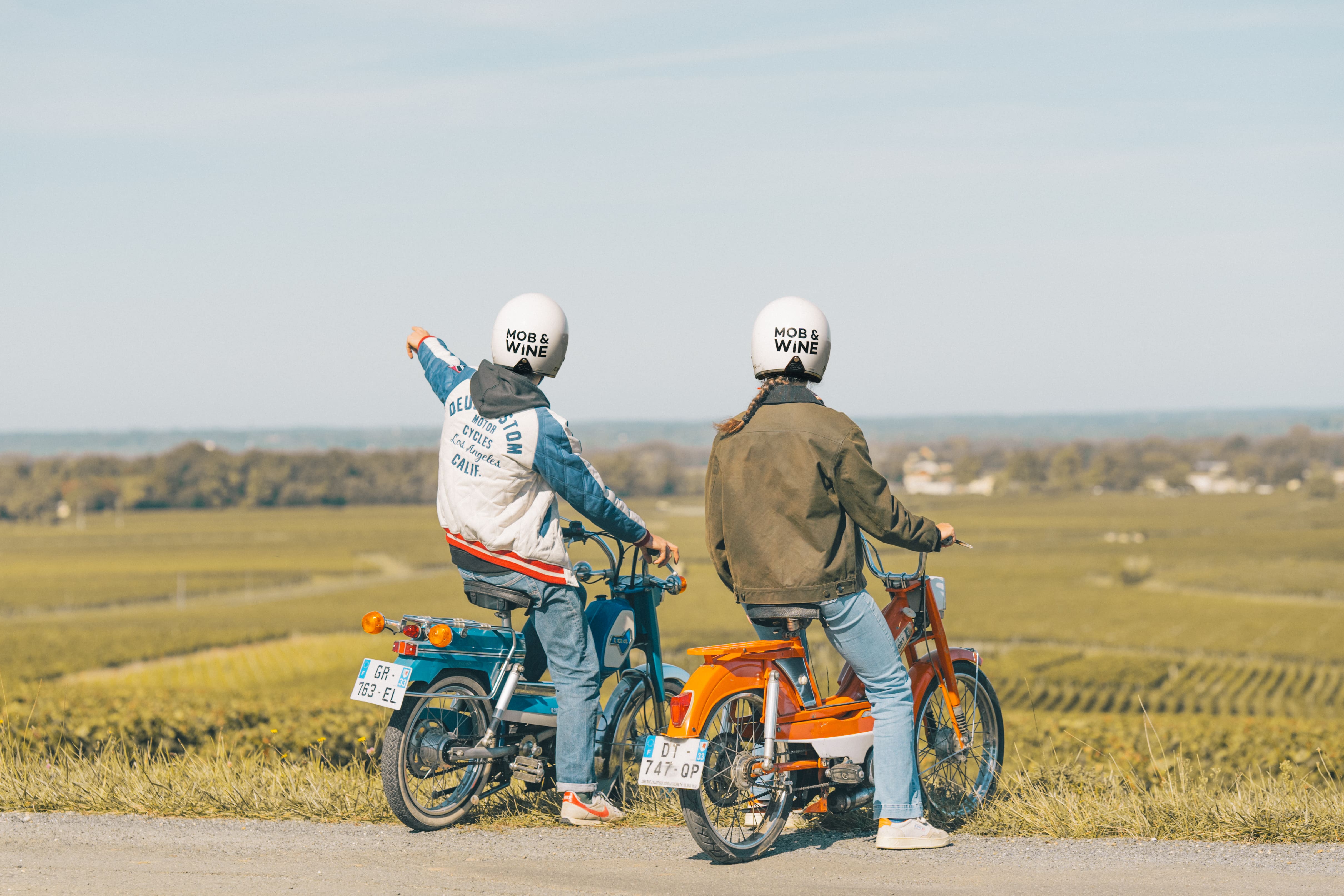
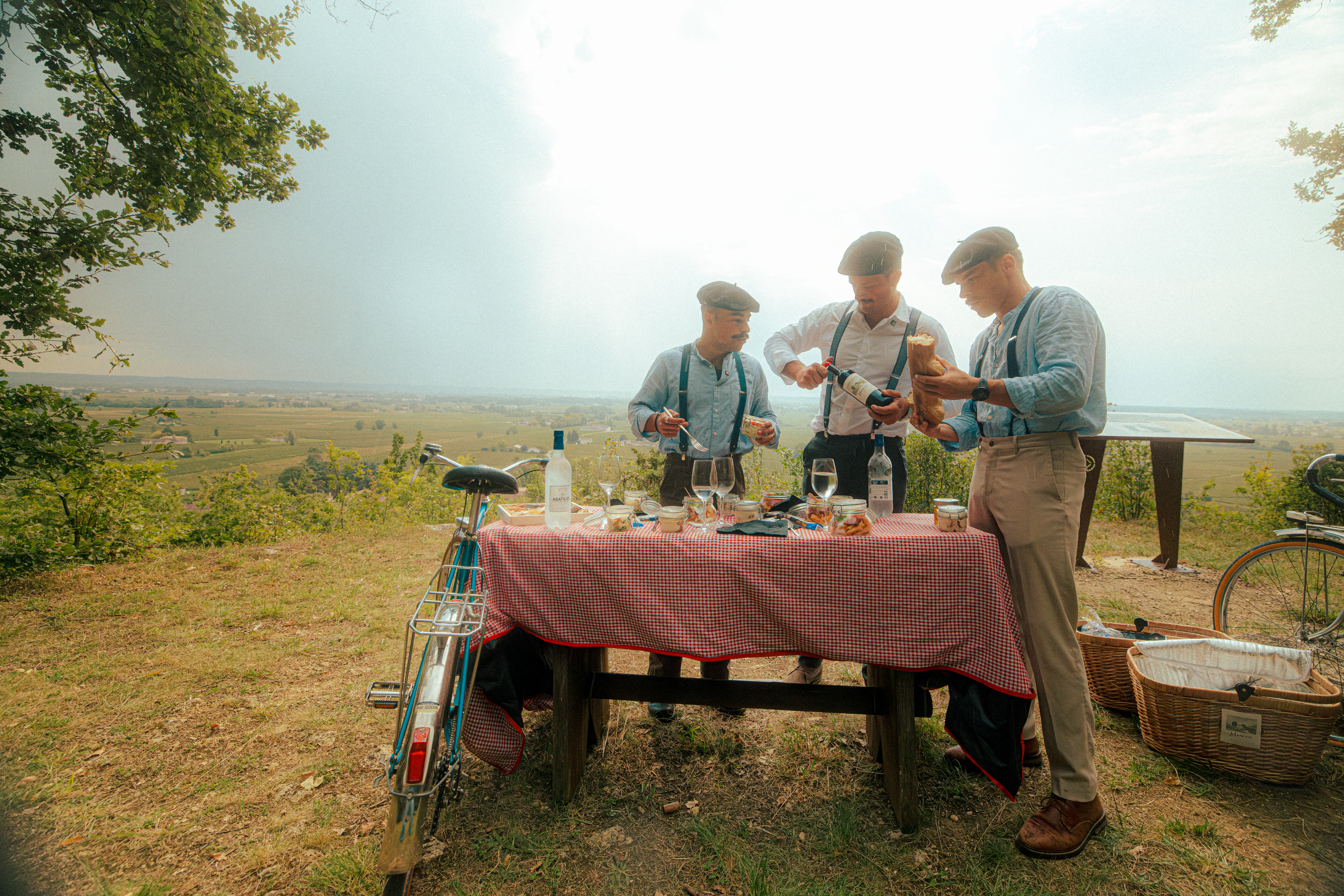
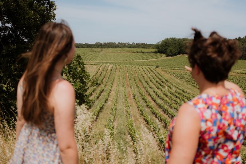
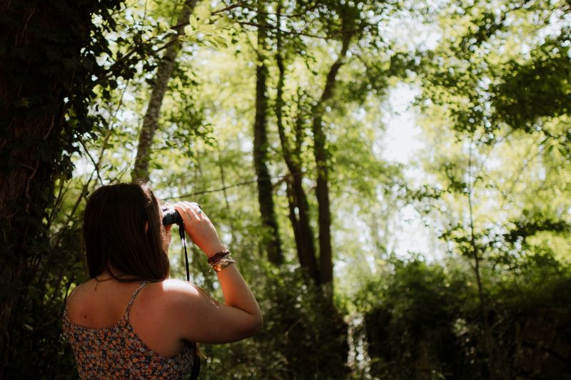
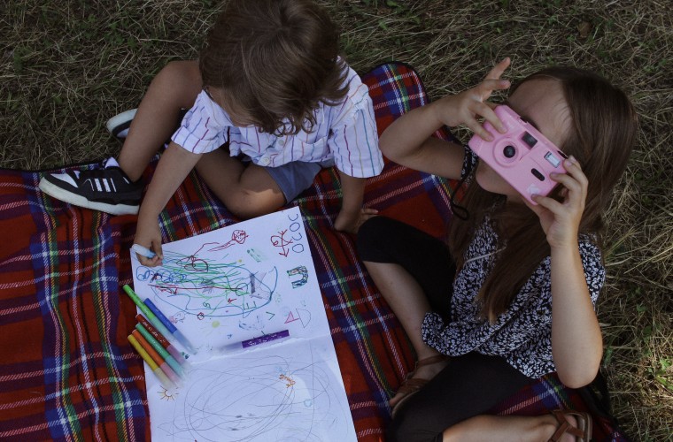
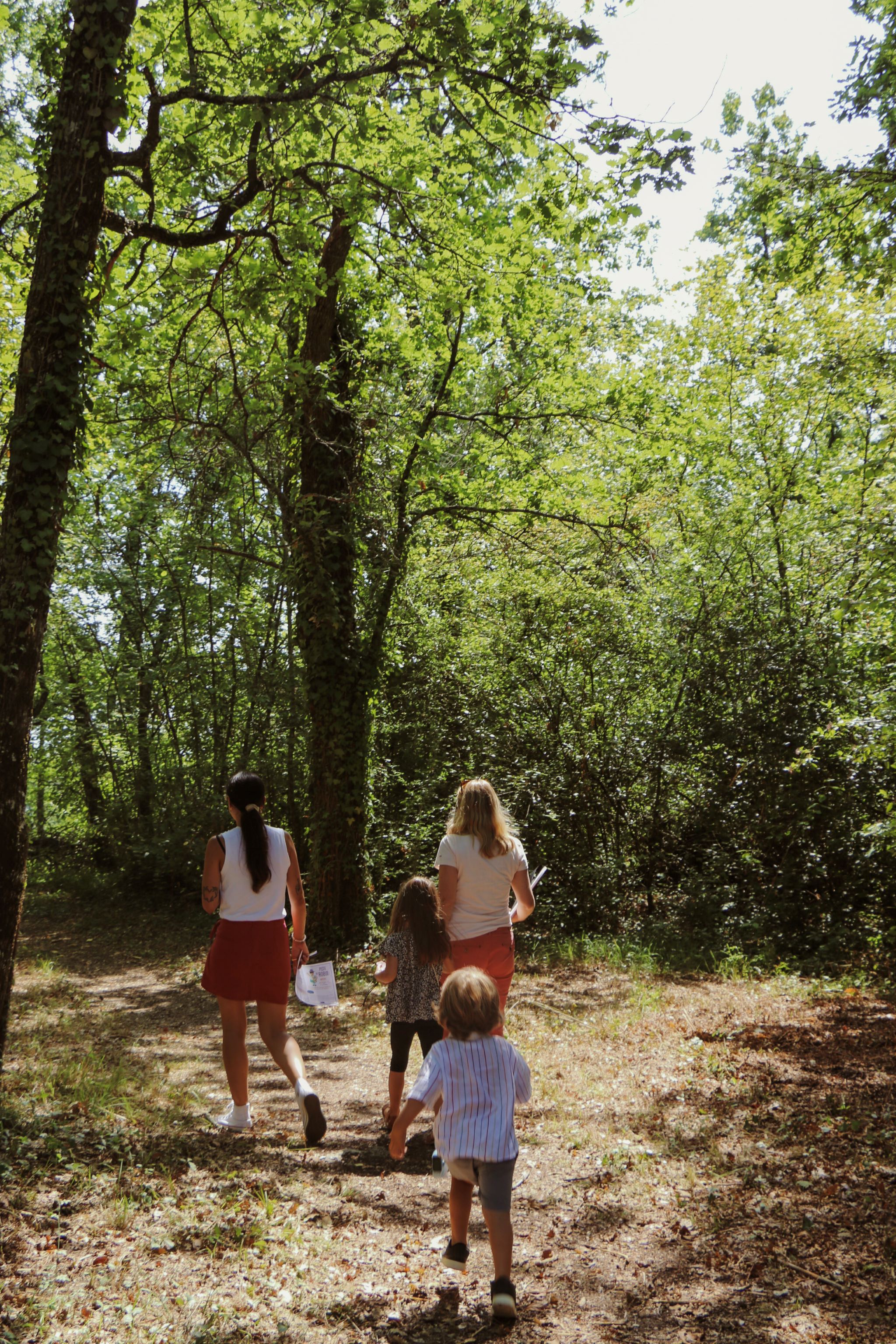
   A bit of history… Saint-Hippolyte takes its name from the eponymous saint, Saint-Hippolyte who was a philosopher during the 3rd century and a brilliant theologian of the Romanesque church, after opposing Saint-Calixte I, he reconciled with the Church and returned to the Catholic faith.   A natural heritage ... The town is crossed by about 600 meters of water courses, mainly consisting of the Langrane Creek.   Vineyards… Its vineyard is included in the famous appellation of wines of Saint-Emilion and produces many wines in AOC Saint-Emilion and Saint-Emilion Grand Cru. More information on the vineyard of Saint-Emilion here.   Points of interest: The view from the Ferrand plateau, where the horizon extends over the Dordogne valley.   Ferrand grottos date from around or well before the 17th century, and are located a few kilometers from the town. It was Elijah Bétoulaud, an unknown poet of the 17th century, that was the author to write about these grottos. There are 3 dug-out rooms : the love room, a cross-shaped room and a lyre-shaped room. There, next to them there is a maze consisting of two symmetrical parts, they were made in tribute to Ms. Scuderi and in honor of King Louis XIV.   The church that was erected on the Ferrand plateau, was built in three stages. The choir dating from the 14th century is actually the old chapel of the castle Saint-Poly, the family home of the Bétouleau family. The nave, which has exposed beams, was added in the 16th century, and the square-shaped bell tower was built in 1783. In 1980 the church was restored.   The Château de Ferrand, erected during the reign of Louis XIV and situated on a plateau of Saint-Hippolyte, is an elegant building dating from the 17th century. Bought in 1978 by the Baron Bich, the castle had major renovations made in respect of the architecture of the time. The castle is composed of two large square pavilions connected by a small main building in the background. Today is a winery that operates in the Saint-Emilion Grand Cru. SITE NOT ACCESSIBLE TO THE PUBLIC.   Cycling and hiking routes made by the Tourist Office going through Saint-Hippolyte: "The terroirs road " for a 6 hour hike "The remarkable architectures" a cycling route of 19 km to discover the wine and architectural heritage of Saint-Emilion. All the routes are downloadable here.       Opening days of the City hall Tuesday: 2:00 p.m. to 6:00 p.m. From Thursday to Friday: 2:00 p.m. to 6:00 p.m.
  • Saint-Laurent-des-Combes

    Saint-Laurent-des-Combes

    To know more about
      Presentation of the municipality Saint-Laurent-des-Combes is a town of 262 inhabitants, part of the Saint Emilion Jurisdiction in the Canton Coteaux de Dordogne, it is located 3km south east of Saint-Emilion on high lands, over 300 m above sea level. its surface area is 386 hectares. Its inhabitants are called the Saints-Laurentais.   A bit of history... The name 'Combes' commemorates the forest "Cumbis" (from the Greek root "Kumbe" meaning cavity) in which the monk Emilion would have found his hermitage at the time of the Moors in the 8th century. Saint-Laurent-des-Combes took part in some great moments in French History. On May 15th, 1814 a large party washeld in honor of the return of King Louis XVIII and for the presence of the Duke of Angoulême in the area: "The white flag is raised. A solemn Mass with the Te Deum is celebrated. A banquet reunites the locals. In the evening there are dances and the town is illuminated."   Town life was situated mainly around the village church, but during the second half of the 19th century, it moved below the hill with the arrival of the railroads.   The town has been marked by several famous people: Jean de Foix, brother in law of King Louis XII, who resided in the Chateau de Candal. Raymond Theodore Troplong, who was President of tyhe Senate (1852-1869), residing at the Chateau Troplong Mondot. Professor Jean-Louis Faure, member of the Academy of Medicine, at the Chateau Bellefont-Blecier, who bequeathed in 1918 to the town 18 hectares of forest in order to make the "green lung" of the Jurisdiction. Also the doctor-general René Labusquiere, grand-son of Jean-Louis Faure, a great source for information on tropical medicine.   A hilly natural heritage An exceptional site formed by a succession of valleys, the town offers a magnificent view from the edge of the limestone plateau where the Romanesque church is located. Then, from the square a view across the Dordogne valley is beautiful. Saint-Laurent-des-Combes has few rivers, the main one is Beuran Creek located 19 meters above sea level. The town has a relatively small area of ​​woodland of 38 hectares. This area is particularly sensitive and is of remarkable biological interest. In 1991 this area was included to the inventory of Natural Areas of Ecological Interest, Fauna and Flora (ZNIEFF).   Saint-Laurent-des-Combes is part of the Jurisdiction of Saint-Emilion, which was listed as a World Heritage by UNESCO as a "cultural landscape". The landscape of hills and valleys succeeding, and its harmonious combination fully justifies this registration. Hiking trails allow visitors to discover the landscapes of vineyards, woods and rural heritage.   Vineyards… Throughout its territory, Saint-Laurent-des-Combes can produce wines from several appellations of Bordeaux, such as Bordeaux and Bordeaux Supérieur. But above all, its vineyard is in the territory of the Jurisdiction of Saint-Emilion, on which the appellations AOC Saint-Emilion and Saint-Emilion Grand Cru are mainly produced. Several of its wineries are part of the circle of Grands Cru Classés and Premiers Grands Cru Classés Saint-Emilion.   More information about the vineyard of Saint-Emilion, here.   Points of interest: The view from the Chuch square over the Dordogne Valley. Several bicycles and hiking routes were made by the Tourist Office of the Greater Saint-Emilion Area through Saint-Laurent-des-Combes: Hiking - UNESCO valley and hills Cycling - The Dordogne Valley and its vineyards Cycling - Remarkable architectures Cycling - Between vineyards and the Dordogne The routes can be downloaded here.     Opening days of the City hall Monday / Tuesday / Thursday / Friday: 9:00 am to 12:30 pm  / 2: 00 pm to 6:00 pm
  • Saint-Pey-d'Armens

    Saint-Pey-d'Armens

    To know more about
    Presentation of the municipality Saint-Pey-d'Armens is a village in the Canton Coteaux de Dordogne and part of the Jurisdiction of Saint-Emilion that is listed as world heritage landscape by UNESCO. The municipality covers 420 hectares, and more than three quarters of this area - extending on both sides of the RD936 - is occupied by extensive vineyards. It is located 7.5 km from Saint-Emilion and 12 km from Libourne. The town has 203 inhabitants, called Peyrelais and Peyrelaises.   A bit of history… Origin of the name In 1793 the name of the town was Saint Pey Darmens. Then in 1801 it became Darmens-Saint-Paix and finally its current name, Saint-Pey-d'Armens.   History The village is crossed by an ancient royal road linking Bordeaux and Bergerac. It is one of 11 parishes forming the old Viscount de Castillon and one of the 8 parishes making up the Jurisdiction of Saint-Émilion, which contributed to the fame of the wine from the latter. More information on the Jurisdiction here.   Natural heritage The town contains about 1.9 km of rivers called the Langrane Creek. The landscape of Saint-Pey-d'Armens was listed as World Heritage site by UNESCO in 1999 as Cultural Landscape, along with all the villages of the Saint-Emilion Jurisdiction.   Vineyards… The wine estates in the municipality of Saint-Pey-d'Armens evolve in the AOC Saint-Emilion and Saint-Emilion Grand Cru. More information on the vineyard of Saint-Emilion here.   Points of interest: The Tourist Office of the Greater Saint-Emilion Area offers a cycling route starting from Saint-Émilion of about 46 km; it passes through the municipality of Saint-Pey-D’Armens : "Tour of the Greater Saint Emilion” downloadable here.   The Saint Pierre Church is a small Romanesque church that has been restructured several times. Dating from the 13th century, it houses a triumphal arch and capitals adorning the columns of the choir that are finely crafted. In the 16th century the cemetery Cross (a Hosannaire Cross) was listed as historical monument. It stands on a base, with four small columns that stand on its four corners. Three sculptures were created on each side of the cross. In the cemetery of Saint-Pey-d'Armens, there is a sarcophagus dating from the 12th century.   Beautiful mansions stand in the landscape of Saint-Pey-d’Armens, such as Chateau Saint-Pey and Chateau Fourney which were designed by architect Victor Louis in the 18th century. The Chateau Fourney built in the 18th century according to the plans of architect Victor Louis, the architect behind the the Grand Théâtre de Bordeaux and beautiful mansions in Bordeaux designed most of his builds in the style of Louis XVI. The central part of this building was completed in 1789, but work was interrupted during the Revolution. The park and the building was completed in 1805. The Chateau of Saint-Pey extends over 20 hectares. It opens onto a large park of 2 hectares where you can glimpse the first parcels of vines. Part of the castle dates from the 16th century and served as dwelling house. The other building is reserved for the winery.     Opening days of the City hall Monday, Tuesday, Thursday and Friday from 8:30 a.m. to 12:30 p.m. Tuesday afternoon: 2:30 p.m. to 6:30 p.m.  
  • Saint-Philippe-d’Aiguilhe

    Saint-Philippe-d’Aiguilhe

    To know more about
      Presentation of the municipality Saint Philippe d'Aiguilhe is a small town of 373 inhabitants located to the east of Libourne, in the Canton of Coteaux de Dordogne. Its inhabitants are called the Saints-Philippois or Saints-Philippoises. Covering a area of ​​587 hectares, it is mainly surrounded by the vineyards of the Côtes de Castillon and Puisseguin. Located 13 km from Saint-Emilion, the town is crossed by the county road RD 123 between Castillon-la-Bataille and Saint-Seurin-sur-l'Isle. in the centre of the town, there is the romanesque Saint-Philippe’s church and a multi-service business (grocery, restaurant, bakery), Town Hall, a Post Office, a school, a multipurpose hall, a stadium and finally a tennis court.   A bit of history… Its name comes from the eponymous saint and the name of the ancient manor of Aighuile, on which the village extends. The village is situated on a promontory of the right bank of the Dordogne river. Human occupation can be traced back to the Antiquity. Indeed, a fortified Gaulish village had settled there during this period.  In the Middle Ages, it is on the old foundations of this small village that the Aiguilhe fortress was erected. Destroyed, then rebuilt the Aiguilhe castle housed a Commandery of Templar  Knights in the 13th century. As for the lordship of Aiguilhe itself, it dates back to the 12th century; at that time it was part of the lordship of Puynormand, located a little further northwest. Today, this small town is particularly "characterized by a certain architectural harmony."   A natural heritage rich in water ... Located 108 meters above sea level, the municipality has no natural reserve. However, four rivers cross the territory of the parish: the Aiguilhe Creek, the Pinpin Creek, the Tuillac Creek and finally the Gueyraude Creek.   Vineyards… The plateau of Saint-Philippe d'Aiguilhe is surrounded by vineyards of the Côtes of Castillon and are integrated to the appellation Castillon Côtes de Bordeaux.   Points of interest: In the municipality of Saint-Philippe d'Aiguilhe, there are several sites to visit: The Candelaïre site, with its mill and its orientation table (GPS: 44.921153, -0.023460). The site of the Château Camp de la Hire. Wash houses, dovecotes The Saint-Philippe church (built between the 10th and the late 12th century) - a listed monument since 1920. The Château of Montagne (11th, late 16th and 19th century) The remains of the Château of Aiguilhe (14th, 17th and 18th centuries) along the Aiguilhe Creek. This castle successively belonged to the Templars knights and to noble families. Its most famous owner was the knight Le Breton, Lord of Aiguilhe in the late 18th century. He was the first President of the Parliament of Bordeaux. The Château has been in ruins since 1904 due to a fire.     Opening days of the City hall  Monday: 2:00 p.m. to 6:30 p.m. / Wednesday: 2:00 p.m. to 6:30 p.m. / Friday: 2:00 p.m. to 6:30 p.m.
  • Saint-Sulpice-de-Faleyrens

    Saint-Sulpice-de-Faleyrens

    To know more about
    Presentation of the municipality Saint-Sulpice-de-Faleyrens is a town situated along the Dordogne for about 10 kilometers, and belonging to the Canton Coteaux de Dordogne. One of eight town forming part of the Jurisdiction of Saint-Emilion, listed as a World Heritage Site by Unesco in 1999 for its historical vineyard landscape. Its area is 1,817 hectares and its located 5 kilometers from Saint-Emilion. The town now has 1,379 inhabitants, called the Saint-Sulpiciens.   A bit of history… Origin of the name Saint-Sulpice-de-Faleyrens is named after the eponymous saint and a tribute to a 7th century Bishop. It is also comming from  Faleiro, faleyre in Occitan, "fern". This reference to the fern is due to the towns once wild woodland  where the plant was found in abundance and the first drinking glasses were made using fern ashes.    History The presence of a menhir near the port of Pierrefitte attests to land occupation from the Neolithic time, around 4,000 years ago. The village's history is closely linked to that of Chateau Lescours’, where the French king, Henry of Navarre, took refuge in the 16th century. Legend has it that Louis XIV took refuge there too. Also, the dock of the village became the port of Saint-Emilion from where wine barrels were exported to Rome or London, via Bordeaux. The town hosts one of the oldest human testimonies of occupation of the Jurisdiction: the menhir of Peyrefitte (from about 2600-2300 years BC), which is the largest of Aquitaine,  and was listed as historical monument in 1889. For thousands of years, for the summer soltice, people gather and celebrate around the menhir; the tradition continues today and is very popular among locals.   A water-rich natural heritage Saint-Sulpice-de-Faleyrens is a town situated on the edge of the Dordogne (listed as World  Biosphere Reserve by UNESCO) for about 10 kilometers. The town is also crossed by about 600 meters of water courses, mainly consisting of the Langrane Creek.   Vineyards… The main activity of the town is related to viticulture. The northeast part of the town is occupied by vineyards producing wines from the appellation Saint-Émilion AOC and Saint-Emilion Grand Cru. One can also find vineyards producing Bordeaux and Bordeaux Supérieur wines. More information on the vineyard of Saint-Emilion here.   Points of interest: The landscape and the land of the parish are favorable for the discovery of fauna and flora and make for the perfect location for cycle rides or walks.    By bike, Saint-Emilion Tourism has completed several routes through Saint-Sulpice-de-Faleyrens (available to download here (Between vine and Dordogne, Tour of the Great Saint-Emilion, the Dordogne Valley and its vineyards).   Outstanding sites: The Pierrefitte menhir, the famous megalith of Pierrefitte lies in the Dordogne Valley, along the road to Libourne from Saint-Sulpice-de-Faleyrens. Unlike other megaliths recorded in France it is carved. It is a monolithic block, which is the result of a huge collective work of Neolithic populations. The builders of this impressive rock probably took it to its current location from a limestone quarry. Its imposing size - 5.20 m height, 3 m maximum width, 1.50 m thick and has a weight of approximately 50 tonnes - make it the largest menhir of Gironde, but also of Southwest France. It represents a right hand with perfect proportions. The limestone is worn on the wrist because many pilgrims came to rub the stone for protection. It is difficult to date this megalith. But it can be estimated to date back from the late Neolithic times (2600-2300 BC).   The Romanesque church of Saint-Sulpice built between the 11th and 12th centuries, was built with stones and its apse was registered in 1925 as a listed historical monument.   The prestigious chateaux have their story linked to the history of the town: Chateau Lescours, Le Castellot or Monbousquet.   Saint-Martial fountain holds according to legend, a cure for ailments of eyes. It is fed by a spring of the same name. initially, it was set as a sanctuary for the pilgrims to the menhir of Pierrefite nearby, and they were able to take advantage of its benefits. The fountain is still preserved today.   Events: Inhabitants celebrate the Pierrefitte menhir every summer solstice. According to belief, the "standing stone" was erected to ensure happiness and prosperity. Thus, young people went there to bless their love. The community life of the town is quite dynamic and many events are organized every year.     Opening days of the City hall Monday to Friday from 9:00 a.m. to 12:30 a.m. and from 2:00 p.m. to 5:30 p.m.